My Zimbio
Top Stories
Showing posts with label Potential Earthchange hotspot. Show all posts

Saturday, June 04, 2016

Expected Mega-quake could Kill 15,000 in 30 Minutes


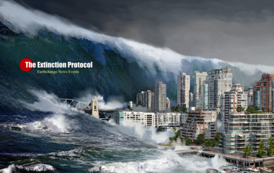
FEMA PLANS MASSIVE DRILL ‘CASCADIA RISING’ 

FOR DEVASTATING QUAKE AND TSUNAMI SCENARIO


The June 7-10 exercise is called Cascadia Rising.

It is named after the Cascadia Subduction Zone — a 800-mile-long fault just off the coast that runs from Northern California to British Columbia.


Recent subduction zone earthquakes around the world underscore the catastrophic impacts we will face when the next Cascadia Subduction Zone earthquake and tsunami occurs:
  • Indonesia (2004): M9.1 --- 228,000 fatalities
  • Chile (2010): M8.8 --- 500 fatalities
  • Japan (2011): M9.0 --- 18,000 fatalities
Published on Jul 16, 2015
Seismologists and federal officials are predicting a devastating earthquake in the Pacific Northwest along the Cascadia Fault line that could, theoretically, leave tens of thousands of people dead and even more displaced. RT’s Simone Del Rosario speaks with seismologist John Vidale about the possibility of a disaster striking.
The Cascadia Subduction Zone off the coast of North America spans from northern California to southern British Columbia.


The Cascadia Subduction Zone off the coast of North America spans from northern California to southern British Columbia. This subduction zone can produce earthquakes as large as magnitude 9 and corresponding tsunamis. Scientific evidence indicates that a magnitude 8.0-9.0 earthquake occurs along the 800-mile long fault on average once every 200 to 500 years. The last major earthquake and tsunami along the fault occurred over 300 years ago in 1700. 
See Larger Original


New post on The Extinction Protocol:

‘Doomsday EQ drill’ in Northwest, largest in US ever: Mega-quake could kill 15,000 people in 30 minutes

by The Extinction Protocol
Cascadia
June 2016 - PORTLAND — Imagine a devastating earthquake and tsunami have cut off Pacific Northwest coastal communities. Phone and internet service have collapsed. Ham-radio operators living on the stricken coast fire up their radios, contact emergency managers and report on the magnitude of the disaster so that no time is wasted in saving lives. This is the kind of scenario that will be rehearsed during the second week of June in a massive earthquake and tsunami readiness drill that has been developed by the U.S. government, the military, and state and local emergency managers over the past few years to test their readiness for what — when it strikes — will likely be the nation’s worst natural calamity.
A diagram of the Cascadia Subduction Zone provided by the Oregon Historical Society.
The June 7-10 exercise is called Cascadia Rising. It is named after the Cascadia Subduction Zone — a 600-mile-long fault just off the coast that runs from Northern California to British Columbia. “This is the largest exercise ever for a Cascadia break,” said Lt. Col. Clayton Braun of the Washington State National Guard. Braun has been a key planner of the doomsday drill, which is being overseen by the Federal Emergency Management Agency. 

Federal officials say about 20,000 people will be involved in the disaster drill, representing various federal agencies, the U.S. military, state and local emergency response managers across the Pacific Northwest, Native American tribes and emergency management officials in British Columbia. One main goal of the exercise is to test how well they will work together to minimize loss of life and damages when a mega-quake rips along the Cascadia Subduction Zone and unleashes a killer tsunami.
Awareness of the seismic threat looming just off the Pacific Northwest dates back to the 1980s, when researchers concluded that coastal lands long ago had been inundated by a tsunami. Research also indicated that a tsunami that was documented in Japan in January 1700 originated from the Cascadia Subduction Zone, also known as the CSZ. Research suggests that the CSZ on average produces magnitude 9.0 quakes every 500 years, but big quakes have been separated by as few as 200 years and as many as 1,000. So it is impossible to predict when the next monster quake occurs. However, tectonic stresses have been accumulating in the CSZ for more than 300 years and seismologists say it could rupture at any time.

More than 8 million people live in the area that is vulnerable to the Cascadia Subduction Zone. It contains the most heavily populated areas of the Pacific Northwest, including Seattle and Portland, as well as Interstate 5, one of the nation’s busiest roads. Coastal towns are especially at risk. Studies have forecast that while 1,100 people could die from a 9.0 magnitude quake, 13,500 could perish from the tsunami that would slam into the coast within 15 to 30 minutes after the shaking begins.

A scenario document written in preparation for Cascadia Rising exercise states “the scale of fatalities across the coast may overwhelm the resources of local governments.” Whole towns along the coast may disappear. Hospitals could either collapse or be too severely damaged to handle casualties. All across the region between the Pacific and the Cascade Range, bridges and roads could be destroyed, fuel supplies and communications disrupted, and buildings and crucial infrastructure may sink into soil that’s been liquefied by the intense shaking. –Seattle Times
Crisis of the Ages
Comment   See all comments   Like


Contributing Sources:


http://www.nowtheendbegins.com/fema-haarp-warning-northwest-prepares-cascadia-rising-devastating-earthquake-tsunami/

http://koin.com/2016/06/03/cascadia-rising-rehearsal-for-pnw-quake-tsunami/

https://www.fema.gov/cascadia-rising-2016


http://wp.me/p1eYXc-bdc

Monday, November 03, 2014

Costa Rica on ALERT- Turrialba Volcano Erupts

This is Turrialba's largest eruption in more than a century, reports Mark Sedgwick


Related Stories

Costa Rica has issued an emergency alert after ash from an erupting volcano reached the capital and beyond.
Turrialba volcano, some 50km (30 miles) east of San Jose, began rumbling and producing seismic activity on Wednesday night.

The authorities said they were evacuating nearby residents to temporary shelters as a precaution.
Eyewitnesses reported fiery explosions and ash falling like snow over parts of central Costa Rica.

This is Turrialba's largest eruption in more than a century.
The National Emergency Commission said volcanologists and other specialists were on site to assess the situation.
Map showing the location of Arenal Volcano in northcentral Costa Rica ...
Costa Rica is home to dozens of volcanoes, but most of them are dormant.
Handout photo released on, 30 October 2014, by the Volcanological and Seismological Network showing Turrialba volcano in Costa Rica. Volcanologists and other specialists were on site to assess the situation
Handout photo released on, 30 October 2014, by the Volcanological and Seismological Network showing Turrialba volcano in Costa Rica. This is Turrialba's largest eruption in more than a century
http://www.bbc.com/news/world-latin-america-29841990


69: Costa Rica’s Turrialba Volcano – shaken by violent eruption

by The Extinction Protocol
November 2014 – COSTA RICA 
Among the observations by volcanologists conducting weekend inspections in the area around Costa Rica’s Turrialba Volcano were craters in the earth measuring up to one meter in diameter – the result of rocks shooting out from the volcano. Experts from the National Seismological Network (RSN) and the Volcanological and Seismological Observatory of Costa Rica (OVSICORI) conducted the inspections in light of significant activity at the volcano that started last week. 
RSN volcanologist Gino González Ilama said the areas of impact are located on the south side of the volcano and cover 80 percent of the slope up to 400 meters from the volcano’s crater. “We observed the impact of volcanic rock that had caused several craters on the ground. We believe the rocks were shot out of the volcano at speeds greater than 100 kilometers per hour, and this proves there is strong activity inside,” González said.
Expelled ash again reached several areas north of San José, located 60 kilometers southwest of the volcano, and several areas in the provinces of Alajuela, Heredia and Limón. According to the RSN, it was the first time ash had appeared in Limón, falling on the city of Guápiles. “The Turrialba Volcano is very active,” González said. “The hole formed after the first explosion has grown and is about 150 meters long and 100 meters wide. It’s getting bigger, and the volcano’s walls continue collapsing because explosions of gas, ash and rock are constant. We also found small amounts of lava.” Volcanologists on Sunday reported two types of eruptions taking place: phreatic – which entails gases, mud and ash – and strombolian – which contains magma and ash. Turrialba Volcano showed signs of activity in 2010 with phreatic explosions. According to OVSICORI, magma hasn’t been expelled from the volcano since 1866. –Tico Times
Comment   See all comments


Survive Anything - Disasters - Economy Collapse - Mobs, Etc. PROTECT YOUR FAMILY!

37 Food Items that will be SOLD OUT after Crisis: Prepare!


How to survive the Coming Food Crisis Click Here


SEW? Get FREE SHIPPING on orders $35+ from Fabric.com


AquaPonics Grow Vegetables without Dirt.

Survival Farming Click Here!

NWO Vision Report Watch 


The Anti-Christ Identity? Can we know it now?


 -  

Ping your blog

Build a shelter, a shed, a little house - Click Here for Instant access to over 12,000 plans

Monday, December 03, 2012

Taiwan rattled by three earthquakes: U.S,China military conclude major disaster drill

New post on The Extinction Protocol: 2012 and beyond

by The Extinction Protocol
http://t2.gstatic.com/images?q=tbn:ANd9GcSZUmStp4VGow4631RsICOjsHIyNuMNWkO6ugoquvAgWYnPJw8fDecember 3, 2012 – TAIPEI Three earthquakes shook Hualien in eastern Taiwan early Monday, with the strongest recorded at magnitude 5.1 on the Richter scale, but there were no reports of casualties or damage, according to the Central Weather Bureau (CWB). The magnitude 5.1 earthquake hit at 1:45 a.m., centered 7.5 kilometers southwest of the Hualien County Hall at a depth of 18.1 km, the CWB's Seismology Center said. The quake caused strong tremors but they did not last long, the center said. 
The Hualien County Fire Department said it has not received any reports of damage. A second earthquake, magnitude 2.8, struck at 2:14 a.m., with the epicenter 9 km west of the county hall at a depth of 11.7 km, the Seismology Center said. It was followed by a magnitude 4.7 temblor at 3:43 a.m., centered 8.5 km southwest of the county hall at a depth of 16.1 km. Taiwan sits in an earthquake-prone area. More than 30 earthquakes rocked the island. –Focus Taiwan
http://www.scmp.com/sites/default/files/styles/980w/public/2012/11/30/44ef6a712bb3531d14af10d363505dc0.jpgChina and U.S. military practice earthquake drill: Military officers of China and the United States have held a joint indoor war game to practice humanitarian rescue and disaster relief in case of an earthquake and consequent nuclear leaks. The two-day exercise, which ended on Friday, was staged in Chengdu, capital city of southwest China's Sichuan Province. A total of 32 people from the two countries attended the drills on humanitarian rescue, based on the scenario of a 7.8-magnitude earthquake in an unspecific Southeast Asian country, causing huge damages, injuries and leaks of chemical and radioactive materials, according to a statement by the Chinese delegation. T
he participants included officials from the China Earthquake Administration and the U.S. government as well as members for functions of intelligence, combat, communication, engineering, anti-chemical and anti-radiation, logistics, medical treatment, journalism, research and rescue as well as legal affairs. The delegations discussed issues of decision-making, organization, command, action and coordination in the rescue mission. Both sides expressed appreciation for the exercise and agreed that the drill will help to deepen practical cooperation in unconventional security fields between the two countries' militaries, the statement said. 
This is the first joint indoor exercise between the two countries' militaries, and is an important part of the eighth exchange activity between the armed forces of the China and the United States on humanitarian rescue and disaster relief, according to Tang Fen, head of the Chinese delegation. After the drill, the U.S. delegation will also visit sites hit by the 2008 Wenchuan quake, the statement added. –EPD
Seismic Watch 3
Comment   See all comments   Like


Survive Anything - Disasters - Economy Collapse - Mobs, Etc. PROTECT YOUR FAMILY!

37 Food Items that will be SOLD OUT after Crisis: Prepare!

NASA knows some things. 2012 Survival Guide


How to survive the Coming Food Crisis Click Here


SEW? Get FREE SHIPPING on orders $35+ from Fabric.com


AquaPonics Grow Vegetables without Dirt.


Survival Farming Click Here!

NWO Vision Report Watch 


The Anti-Christ Identity? Can we know it now?

2012 - The Untold Story Click Here


Ping your blogAnd Chomp it www.Hypersmash.com

10 Day Weight Loss Pills

Popular Posts

URGENT - Your LIBERTY at RISK


GET A GROUPON!


Curious about what the future holds? Click here to find out how you can receive a 10 minute psychic reading from Psychic Source.

Calculator-1.com - The Best Free Online Calculatorн

Fine Art - Painting Lessons: Real Art!
What is Bio-Farming? Can anyone do it?
Related Posts Plugin for WordPress, Blogger...

CURRENT MOON
My Zimbio
Top Stories
 
My Zimbio
Top Stories Get 100 FREE Visitors to Your Website!
eXTReMe Tracker
AyurCat for Cat Health Care