


 |
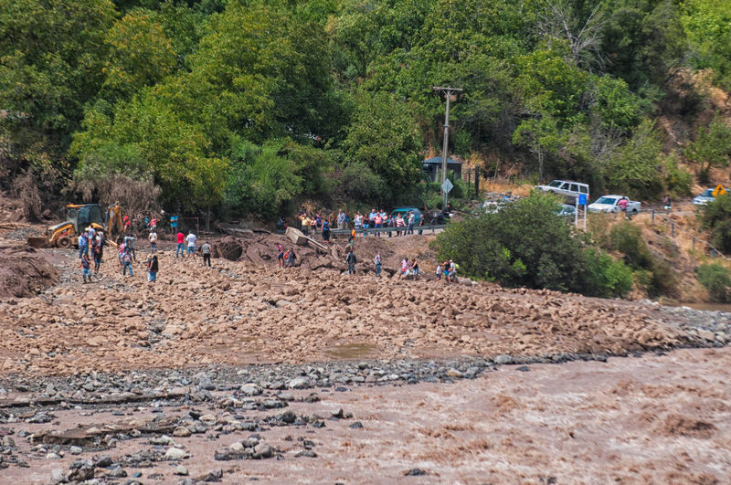
| © Reuters. People walk along a damaged road after a flood near Santiago, Chile |


 Author Tom Clancy called it a “canary trap.” You give multiple sources multiple versions of events. When the sources repeat their version word for word, you can identify each leaker individually.
 Magic determined in early 1942 that the Japanese were close to carrying out a major attack. However, the location of the attack—which the Japanese called “AF”—could not be figured out. Therefore the Americans carried out a barium meal: Using an underwater cable, they contacted Midway Island, telling the base to broadcast a radio message “in the clear” that the desalinization plant had broken down.


FLOOD WARNING
NATIONAL WEATHER SERVICE SACRAMENTO CA
757 PM PST SUN FEB 19 2017
...The National Weather Service in Sacramento has issued a Flood
Warning for the following rivers in California...

  Cosumnes River At Michigan Bar
...The Flood Warning continues for the following rivers in
California..
  San Joaquin River Near Vernalis
...The Flood Warning continues for the following rivers in
California...

  Tuolumne River At Modesto

.High water conditions will continue on the lower San Joaquin
River system for the next several days. Renewed rises will develop
on the Cosumnes River as inflows increase with incoming storm
systems.

Forecasts are based on present and forecasted meteorological and
hydrologic conditions at time of issuance.

PRECAUTIONARY/PREPAREDNESS ACTIONS...

Unlisted forecast points are expected to remain below monitor stage.
All those affected by river conditions should remain alert for rapid
changes and for possible forecast revisions.

For more hydrologic information and stage definitions refer to the
following web site:  http://www.wrh.noaa.gov/sto/hydro_data.php


The next statement will be issued Monday February 20, 2017 at 300 AM.

&&

CAC005-017-067-210556-
/O.NEW.KSTO.FL.W.0042.170220T2348Z-000000T0000Z/
/MHBC1.1.ER.170220T2348Z.170221T0300Z.000000T0000Z.NO/
757 PM PST SUN FEB 19 2017

The National Weather Service in Sacramento has issued a

* Flood Warning for
  The Cosumnes River At Michigan Bar.
* from Monday afternoon until further notice...Or until the warning
  is cancelled.
* At  6:30 PM Sunday the stage was 6.6 feet.
* Minor flooding is forecast.
* Forecast to rise above monitor stage of 7.0 FT early tomorrow
  morning then expected to rise above flood stage of  12.0 FT
  tomorrow afternoon then forecast to rise to near  13.0 FT tomorrow
  evening with continued rise expected.
* Flood stage 12.0 ft
* Monitor stage 7.0 ft
* Impact...Near 12.0 feet, Water flows on to the road near Wilton.
* Impact...Near 8.0 feet, Low lying lands along the river begin to
  flood.

 &&

LAT...LON 3848 12133 3859 12103 3842 12092 3836 12124


$$
FLOOD STATEMENT
NATIONAL WEATHER SERVICE SACRAMENTO CA
353 PM PST SUN FEB 19 2017

...The Flood Warning continues for the following rivers in
California...

  Clear Lake At Lakeport
  Yolo Bypass Near Lisbon

.Flooding will continue at Clear Lake and at the Yolo Bypass through
at least Tuesday, and likely through the rest of the week due to
additional storms. Rises and higher stream flows are also forecasted
on the Lower Sacramento River System through Tuesday and into Wednesday.

Forecasts are based on present and forecasted meteorological and
hydrologic conditions at time of issuance.

PRECAUTIONARY/PREPAREDNESS ACTIONS...

Unlisted forecast points are expected to remain below monitor stage.
All those affected by river conditions should remain alert for rapid
changes and for possible forecast revisions.

For more hydrologic information and stage definitions refer to the
following web site:  http://www.wrh.noaa.gov/sto/hydro_data.php


The next statement will be issued Sunday, February 19, 2017 at p PM PLT.

&&

CAC095-113-210152-
/O.CON.KSTO.FL.W.0020.000000T0000Z-000000T0000Z/
/LSBC1.1.ER.170208T1540Z.170212T0815Z.000000T0000Z.NO/
353 PM PST SUN FEB 19 2017

The Flood Warning continues for
  The Yolo Bypass Near Lisbon.
* At  3:15 PM Sunday the stage was 22.1 feet.
* Minor flooding is occurring and Minor flooding is forecast.
* Forecast to fluctuate near 22.0 FT thru near tomorrow midnight then
  forecast to rise to near  22.0 FT Tuesday afternoon with continued
  rise expected.
* Flood stage 19.0 ft
* Monitor stage 13.0 ft
* Impact...Near 22.5 feet, Kerney Ranch house floods.
* Impact...Near 19.0 feet, Mound Farms and Senator Outing Duck Club
  are flooded.
* Impact...Near 16.0 feet, Glide In Ranch is completely flooded.
* Impact...Near 15.0 feet, County Road 155 is flooded west of the
  Golden Sprig Duck Club.
* Impact...Near 14.0 feet, Skyrakers Duck Club ponds begin to flood.
* Impact...Near 13.0 feet, Flood waters extend approximately 1 mile
  west of the tow drain downstream of the Lisbon gage.
* Impact...Near 12.0 feet, County Road 107 is flooded.
* Impact...Near 11.0 feet, Glide In Ranch & Mound Farms begin to
  flood.
* Impact...Near 10.5 feet, Local roads on the east side of the Yolo
  Bypass south of the I-80 causeway are flooded.
* Impact...Near 9.5 feet, Yolo Bypass flooding extends 1/4 mile west.
  No structural damage is occurring.

 &&

LAT...LON 3878 12176 3879 12156 3854 12156 3820 12164
      3822 12182

$$
URGENT - WEATHER MESSAGE
National Weather Service Sacramento CA
318 PM PST Sun Feb 19 2017

...Strong winds over northern California the next couple of
days...

.A strong Pacific storm will bring potentially damaging winds to
northern California as it approaches and moves through the region.
Breezy winds today and Monday will peak Monday evening through the
night as this system pushes through. Downed trees and widespread,
long-lasting power outages are likely especially Monday evening.
Blowing debris hazards are also possible.

CAZ017>019-201400-
/O.UPG.KSTO.HW.A.0002.170221T0300Z-170221T0900Z/
/O.NEW.KSTO.HW.W.0004.170221T0000Z-170221T1200Z/
/O.EXT.KSTO.WI.Y.0020.170220T1800Z-170221T0000Z/
Southern Sacramento Valley-Carquinez Strait and Delta-
Northern San Joaquin Valley-
Including the cities of Sacramento, Fairfield/Suisun, Stockton,
and Modesto
318 PM PST Sun Feb 19 2017

...WIND ADVISORY NOW IN EFFECT FROM 10 AM TO 4 PM PST MONDAY...
...HIGH WIND WARNING IN EFFECT FROM 4 PM MONDAY TO 4 AM PST
TUESDAY...

The National Weather Service in Sacramento has issued a High Wind
Warning, which is in effect from 4 PM Monday to 4 AM PST Tuesday.
The High Wind Watch is no longer in effect.

* TIMING...Gusty winds this evening and Monday will maximize
  Monday evening. Winds will decrease overnight Monday with
  relatively light breezes on Tuesday.

* WINDS...Winds increasing to 20 to 30 mph with gusts to 45 mph by
  late Monday morning. Winds peaking Monday evening into early
  Tuesday morning, with gusts of 50 to 65 mph.

* IMPACTS...Downed trees, blowing debris, and widespread,
  potentially long-lasting power outages.

PRECAUTIONARY/PREPAREDNESS ACTIONS...

A High Wind Warning means a hazardous high wind event is expected
or occurring. Sustained wind speeds of at least 40 mph or gusts
of 58 mph or more can lead to property damage.

A Wind Advisory means that winds of 35 mph are expected. Winds
this strong can make driving difficult, especially for high
profile vehicles. Use extra caution.

&&

Interact with us via social media
www.facebook.com/nws.sacramento
www.twitter.com/nwssacramento

$$
Flood Statement
National Weather Service Sacramento CA
959 AM PST SUN FEB 19 2017

CAC003-005-007-009-011-017-021-033-035-057-061-063-067-077-089-091-
095-099-101-103-109-113-115-240000-
/O.CON.KSTO.FA.W.0011.000000T0000Z-170224T0000Z/
/00000.0.ER.000000T0000Z.000000T0000Z.000000T0000Z.OO/
Colusa CA-Yolo CA-Sutter CA-Solano CA-Plumas CA-Alpine CA-Placer CA-
Shasta CA-Lassen CA-Amador CA-Tuolumne CA-Sacramento CA-Lake CA-
Stanislaus CA-San Joaquin CA-El Dorado CA-Calaveras CA-Tehama CA-
Butte CA-Glenn CA-Sierra CA-Yuba CA-Nevada CA-
959 AM PST SUN FEB 19 2017

...A FLOOD WARNING FOR URBAN AREAS AND SMALL STREAMS REMAINS IN
EFFECT UNTIL 400 PM PST THURSDAY FOR COLUSA...YOLO...SUTTER...
SOLANO...PLUMAS...ALPINE...PLACER...SHASTA...LASSEN...AMADOR...
TUOLUMNE...SACRAMENTO...LAKE...STANISLAUS...SAN JOAQUIN...EL
DORADO...CALAVERAS...TEHAMA...BUTTE...GLENN...SIERRA...YUBA AND
NEVADA COUNTIES...

* Interior Northern California will experience another significant
  uptick in flooding problems starting late tonight and continuing
  through Monday night as an intense Atmospheric River type storm
  arrives.

* Our entire region has saturated soils and many flooded areas
  already.  This will enhance the impact of additional heavy rains
  this week.

* Additional stress will be placed on levees, rivers, creeks, and
  streams.

* We may see flooding in locations which haven`t been impacted in
  many years.

* We are strongly advising all residents in interior Northern
  California to be prepared for flooding.

PRECAUTIONARY/PREPAREDNESS ACTIONS...

Be prepared to evacuate if flooding should affect your area.  Gather
a "go bag" with important items like medications and hard to replace
documents.  Do not forget to plan for you pets and animals.

Please never drive across flooded waters and roadways, especially
flowing water.  Most people who are killed or injured during floods
are attempting to drive through flooded waters.  Turn around, don`t
drown!

LAT...LON 3725 12146 3810 12157 3808 12230 3832 12206
      3884 12229 3867 12262 3907 12309 3950 12306
      3955 12288 4033 12307 4058 12269 4117 12246
      4118 12250 4118 12133 4059 12132 3835 11963
      3776 11988 3780 12018 3713 12122

$$

MK
 |
| Mind over matter? One government test of paranormal abilities tasked alleged psychic Uri Geller with replicating unseen drawings, such as a bunch of grapes. Geller's result (right) was produced in isolation from the target illustration. Credit: PD-US |


